|
SCENES from West of IRELAND - County Cork Courtmacsherry (Irish: Cúirt Mhic Shéafraidh, meaning 'MacSherry's Court'), is often referred to by locals as Courtmac, and a most pleasant seaside village in County Cork, on the southwest coast of Ireland. Courtmacsherry village consists of a single long street called Main Street on the southern shore of Courtmacsherry Bay, and there several good pubs, cafes and seafood restaurants to get refreshment Woods were planted by the Earl of Shannon in the late 18th century are situated eastwards beyond the village to the open sea, ending at Wood Point, all adding to area being part of the Wild Atlantic Way. Between the village
and "The Point" the trees run right to the water's edge and there are
several natural bathing coves and nice beaches along the way - a coast
road eastwards can be followed and then minor roads to the south and
east.
See also 139j
Timoleague Friary 139k
The churches of Timoleague 139l
The Timoleague to Courtmacsherry estuary walk *
Looking across from the R600 road to the woods near Courtmacsherry from the northern shoreline of Courtmacsherry Bay. Courtmacsherry Bay stretches between Seven Heads and the Old Head of Kinsale. What you are looking at here is a small branch flowing inland up to Timoleague. The bay has a relatively sheltered location and hence popular with water sports enthusiasts.
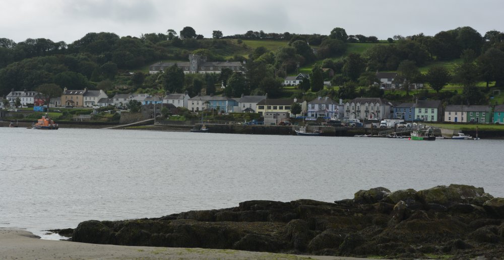
A general view of Courtmacsherry
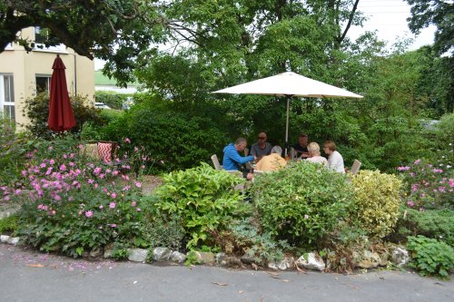
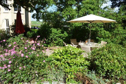
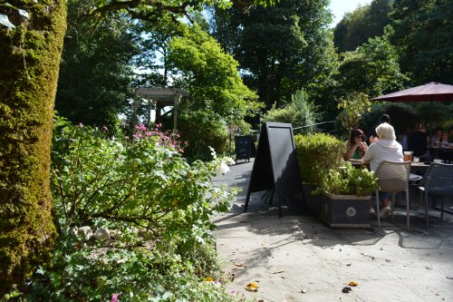
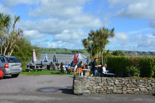
The Golden Pheasant Garden Cafe and Crafts Shop, an excellent place for food and drink (pictures of the garden above and below).
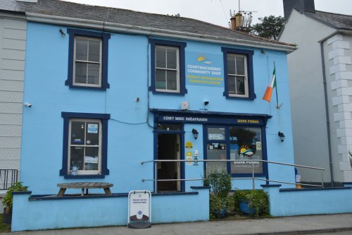
The local Courtmacsherry Community shop tourist information centre and exhibition, next and to The Pier House Bar, Main Street.
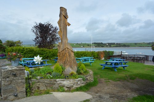
The Lifeboat Inn bar pub, Main Street, and 'beer garden' overlooking the bay and Courtmacsherry harbour.
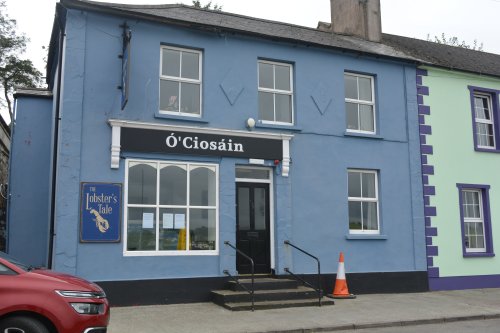
The Lobster's Tale restaurant, Main Street, Courtmacsherry, a cafe for takeaway fish and chips too!
Travara Lodge, Main Street, Courtmacsherry, another good place for food and outside garden tables overlook the estuary.
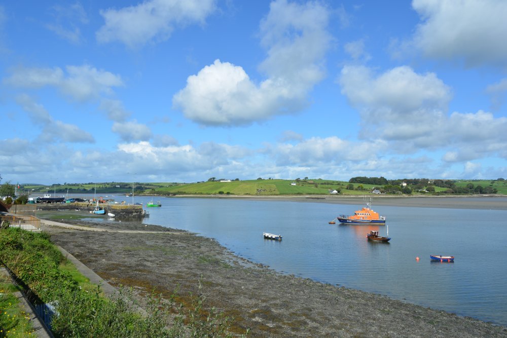
Courtmacsherry Harbour.
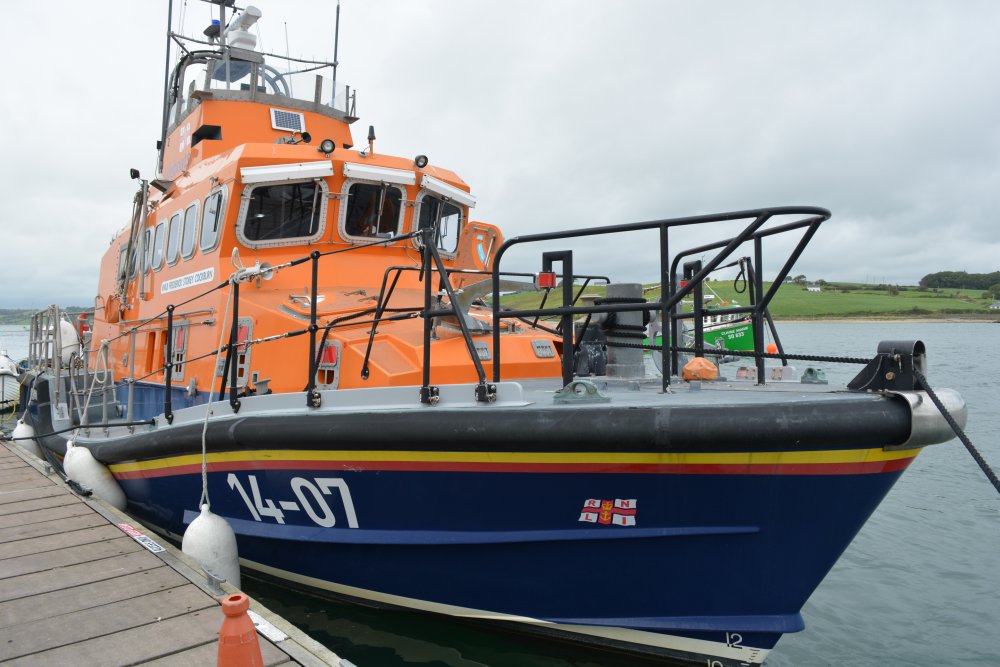
The 14-07 RNLB "FREDERICK STOREY COCKBURN" named RNLI Courtmacsherry harbour lifeboat.
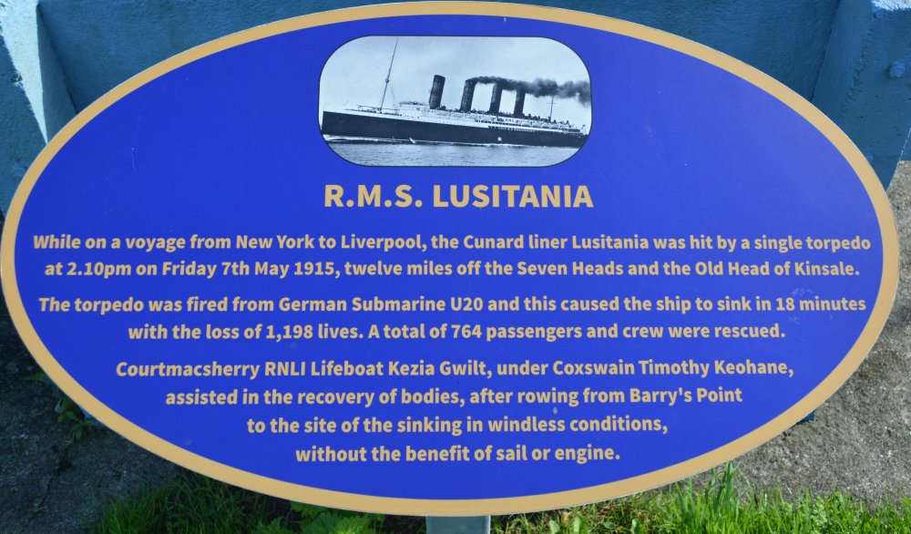
The Courtmacsherry lifeboat connection with the WWI sinking of the Cunard Liner the Lusitania.
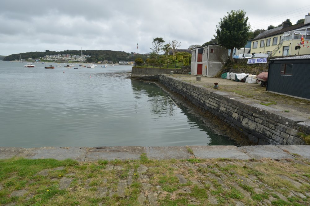
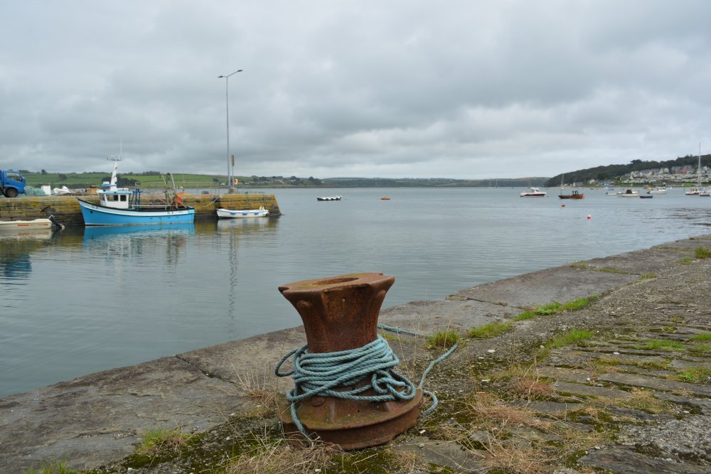
Some of the old quay survives along with some of the mooring bollards of Courtmacsherry harbour.
Originally the bay estuary was called Timoleague Bay, but is now known as Courtmacsherry Bay. to add T links Timoleague was the head of the navigation and thrived from wharfs built in front of the medieval Priory. Unfortunately for the port, a catastrophic earthquake occurred in Portugal in 1755, causing a huge tsunami to hit the coasts of Britain and Ireland and dramatically changed the topology. After this Courtmacsherry Bay harbours were no longer navigable for sea-going vessels up to Timoleague. So, new piers and quays were built further to the east, closer to the mouth of the estuary, on the north facing shoreline. The place we now call Courtmacsherry didn’t exist until after this maritime event, the quays you see today were built from 1870 to 1880. The quays were connect by a light railway to Timoleague, in later times its importance as a port seems to have declined. However, there was an Abbey in Abbeymahon in the 1200s so people had recognised early on how desirable the area was!
A general view seawards from Courtmacsherry Harbour.
Yachts and motor boats moored by Courtmacsherry harbour.
A small fishing boat near Courtmacsherry harbour (Elaine Marie, SO 633, to be precise!)
Two general views of Courtmacsherry harbour and estuary.
See also 139j
Timoleague Friary 139k
The churches of Timoleague 139l
The Timoleague to Courtmacsherry estuary walk
|


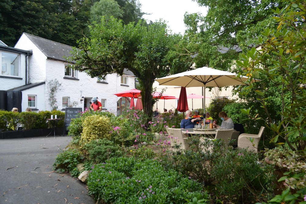
 A great cafe in Courtmacsherry








 The RNLB Courtmacsherry Harbour lifeboat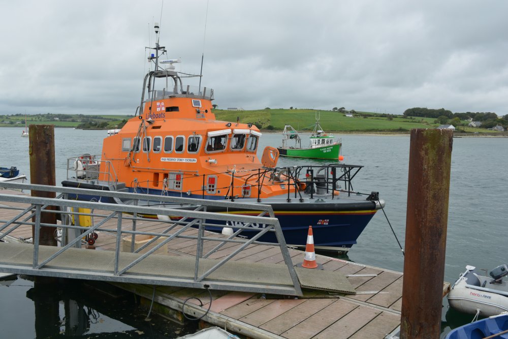







 Enter Irish place, heritage site, feature, walk, town, village, city, museum, historic building,
mountain, island, walk, anything of interest in Ireland!
Enter Irish place, heritage site, feature, walk, town, village, city, museum, historic building,
mountain, island, walk, anything of interest in Ireland!