|
 Enter place, walk, mountain, hill, village, town. city, feature, historic site or
building, museum, anything of interest!
Enter place, walk, mountain, hill, village, town. city, feature, historic site or
building, museum, anything of interest!
|
|
2. From Castleton to Blakey Ridge via the
Ralph Crosses *
2a. Castleton Village 2a(i) Primrose Hill
Some of the older houses in Castleton close to where the first Norman Castle was. I think these were built in the early 19th century but probably on the site of earlier houses.
Where did this piece of old masonry come from on the back entrance of one of the houses on Primrose Hill-Castle Hill? The carving looks medieval or Tudor? One source dates it from 1275-1325 and possibly the lintel of a fireplace?
The Millennium sun-dial stands on the small green of Primrose Hill. John Wesley preached here in 1772 and another side mentions the once famous Castleton Cheese fair. Strictly speaking, Castleton could once be considered a 'town' because of its important fair!
2a(ii) The Road bridge
This bridge was built around 1870 to replace the medieval bridge which was sadly domolished soon after, though for a short time both existed together.
2a(iii) Castleton School and Old Schoolhouse
The now, Castleton Community Primary School was built in 1874 and on the school building and the Old Schoolhouse (with its tall chimneys!) gatepost the letters DBS are inscribed standing for Danby Board School after the School Board Act of the early 1870's to provide a wider ranging provision of education.
2a(iv) The Norman Motte and Bailey
As you enter the village, climbing up the winding road from the station and River Esk bridge, the mound of the Norman motte is on your left and still retains a defensive earthwork on this side (the top of this is the top left of the picture and is now tree capped).
2b. Castleton Environs 2b(i) Danby Park Wood - 'Castleton Woods'!
This is one of the remnant sections of a great medieval hunting wood that stretched from Commondale to Lythe. 2b(ii) The prehistoric cairn on the top Danby Low Moor - Pike Howe
Looking from Pike Howe towards Danby and on down the Esk Valley. The cairn stands on the flat topped western side of Danby Low Moor.
2b(iii) The Box Hall Enclosure Above Box Hall, on the Castleton to Commondale bridleway, are the faint earthwork outlines of a Late Bronze Age or Iron Age? enclosure measuring ~52m x ~60m. OS Grid ref. NZ 678094 or 677095 ?
The bank and ditch is plainly seen on the south-west corner of the enclosure, though the ditch seems to follow on from a curved rising track approaching it.
The north-east corner of the enclose - the surrounding ditch clearly seen.
The south-west corner of the enclosure
Looking south, down onto the enclosure (near sheep!) with the red tiled roofs of Box Hall further down.
2b(iv) The old mill race system to the Castleton mills below The Howe
The water was taken from Danby Beck about a kilometre from where the manorial mill stood below The Howe at Castleton. A channel was dug all the way to Ashfield Farm where the mill race channel water flow is divided between the mill below Ashfield Farm and a reservoir-pond which supplied a 2nd mill across the road. 2c. Defensive dykes on Castleton-Blakey Ridge road 2c(i) Two defensive dykes south of Castleton Rigg-Brown Hill OS grid 681040 High Stone Dyke and 682048 Cross Dyke
High Stone Dyke is at 90o to the road to Blakey Ridge, which itself follows an ancient prehistoric track route and medieval road, and guards across the narrowest southern part of Castleton Rigg
-
Cross Dyke - you look east through the ditch gap down into Danby dale.
Looking west, beyond is Westerdale.
2d. Standing Stones, Crosses & Tumuli on the Castleton-Blakey Ridge road 2d.(i) The 'new' Ralph's Cross
'New/Young' Ralph's Cross (east) OS grid reference 675022/677022?
2d(ii) 'Old' Ralph's Cross
'Old' Ralph's Cross (west) which can't be seen from the road (OS grid 675020/675019?).
2d(iii) The Margery Bradley Boundary Stone
It is disputed that this is a prehistoric standing stone which lies on the road between Blakey Ridge and Ralphs Cross. It is called Margery Bradley (OS grid 675013) and was definitely a boundary stone of the Feversham Estates from the 18th-19th century? However, the 'deep 'fluted' erosion of the top suggests its been standing there for a very long time! Maybe they just re-used a prehistoric megalith?
2d(iv) The 'Fat Betty' White Cross
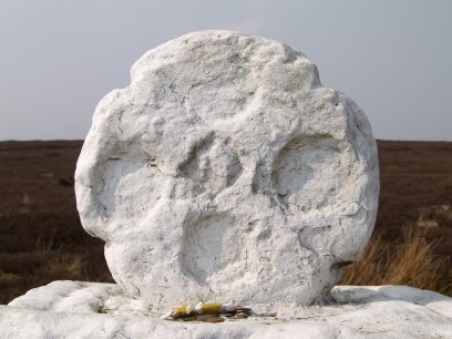
Fatty Betty is just off the Blakey Ridge road on the left on the way down to Rosedale 682020/683019/686016?.
- 2d(v) Millennium Stone
The 3rd Millenium Stone is just off the Ralph's Cross - Rosedale Abbey road at OS grid ref 698013 and is a true modern megalith raised in spirit of all the many prehistoric standing stones found across the the North Yorkshire Moors. The stone mason was Mike Weatherill of Danby. 2d(vi) The standing stone by the Blakey Lion Inn
2d(vii) The standing/boundary stone south of the Blakey Inn
Fragments of North Yorkshire Moors history & archaeology sites * docspics photos images pictures © Phil Brown Northern England * Archaeological and Historic Holiday Trips, Historic Towns, Villages, Buildings, Museums |